| Laboratories \ Laboratory for Ecology of Arid Territories \ Goals and Tasks |
| Goals and Tasks |  | Publications | | Scientific Staff |
 |
LABORATORY FOR ECOLOGY OF ARID TERRITORIES
Address: Laboratory of ecology of arid territories, MAIN GOALS AND TASKS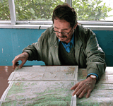
The head of Laboratory P.D. Gunin 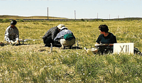
Field works in the Gobi, Mongolia 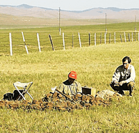
Field studies, Mongolia 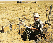
The study of arid ecosystems The Laboratory carried out the works according two directions of scientific research:
Most important achievements of the Laboratory for the period since 1997 till 2002 Modern methods of study and monitoring of dynamics of graze degressive processes in plant cover were developed for Eastern-Asian sector of the steppers based on space photoinformation. The analysis of modern processes of plant degradation was carried out for Mongolia in the light of global and regional landscape-ecological problems. As a result of the work, the Strategy of Nature Management (usage of the plant resources) and conservation of vegetation in extreme ecological conditions of cryoaride climate was developed. For the first time, an approach to reflection of floristic and phytocenotic diversity of plant cover of transitional zone of the mountains in South Siberia and Central Asia on thematic maps was elaborated. A prototype of the Atlas for the vegetation in ecotonic zone of South Siberia was created, which included more than 40 small-scale and medium-scale maps. Natural and athropogenic factors of distribution and dynamics of Mongolian vegetation were analyzed. The analysis of paleogeographic aspects of vegetation dynamics was given, into which a review of preliminary studies on the history of development of the plant cover of Mongolia was included, and also the results of original research connected with the study of modern palynological surface spectra, regional palynological studies of lacustrine sediments and the results of radiocarbon dating of the macro- and microfossils from the columns of the bottom lacustrine sediments. In the issue for the first time a reconstruction of the spatial-temporal changes of vegetation for the latest 15 thsnd years was carried out. Cartographic and empirical models of the condition of the natural ecosytems in the Selenga River basin were created with the characteristic of going in them processes of degradation and with the methodology of their well-timed diagnostics and possible prevention. The processes, being in charge of self-organization and steady functioning of native phytocenoses in conditions of increasing anthropogenic load were revealed and described. Empirical materials of the study in the Selenga Basin pointed out the deepening of ecologically hazardous discrepancy between biotic potencies of landscapes and anthropogenic influence on them. The distance-cartographic method of ecological economical evaluation of the ecosystem conditions at regional level was developed. The series of forms of maps for ecological economical evaluation of ecosystem condition was created by the example of the central part of the basin of the Selenga River. Nature-conservative measures on reconstruction of the degraded ecosystems and biodiversity maintaining were developed for the region specified; the mechanism of biological desertization leading to formation of socially dangerous landscapes was disclosed. Five monographs were published in Russia and one monograph was issued abroad; 57 articles were published in Russia and 12 ones abroad, and also more than 65 abstracts of International conferences. Prime scientific achievements of the Laboratory (problem group, division) for the period since 2002 till 2006: For the first time according to entire method a series of medium-scale maps was elaborated (1:500°000) for the condition of natural environment of the Selenga River Basin (including Russian and Mongolian parts). As a result of the studies of the regions with a high ecological risk, a map of complex ecological zoning for the whole Selenga River Basin was developed in order to allocate the territories of particular routing of nature management and their ecological intensity. The results of the Laboratory works on ecological biological estimation of the condition of natural environment of the Selenga River Basin were used during the development of the Conception of Conservation and Rational Use of Natural Resources in Baikal Natural Territory. The principles and methodical basics for creation of the Database (GIS) on plant resources of the Selenga Basin were elaborated, which were put into practice due to theoretical justification of the basin approach to creation of geoinformation system (GIS) and formation of the basic maps at the scale of 1:500°000 for the basin of the Selenga River and elaboration of author's model maps for the model polygon at the scale of 1:200°000. Creation of generalized databases on plant cover of ecosystems and plant resources according to entire standard method for the territory of all Selenga Basin was made for the first time. Specificity of transformation of the spatial structure of the steppe ecosystems in forest-steppe and steppe regions of the Eastern-Asian sector of arid zone of Eurasia was determined. This specificity lied in dominated state of the bushes, subshrubs and dwarf subshrubs in plant associations of Daurian-Mongolian steppes and their increasing role according the basic parameters of the association structure in the process of succession dynamics, determined both by natural (aridization of the climate) and anthropogenic factors (pasturage and overpasturage). By the example of model associations, it was revealed that in the process of aridization of the climate and increase of grazing pressure of registered in recent decades in the Eastern-Asiatic sector of the steppes and forest-steppes an expansion of alkaloid plants and intrusion into automorphic ecosystems of shrub species and, thereafter, displacing of grass species from the dominant composition. The study of physiological and morphological parameters showed that most of shrub species of Daurian steppes were more tolerant to arid stress, determined by dehydration of soils and decrease in moisture reserve. It was determined that on the southern border of boreal forests in the Eastern-Asiatic sector of forest-steppes in the modern period of the climate aridization the character of succession of soil-plant cover evidenced the radical reorganization of ecosystems. Contrary to the typical taiga forests, re-storing their potential via the secondary forests, the possibility of mass seminal renewal not only of the coniferous, but also small-leaved species was practically excluded here. Moreover, such conditions at all phases of succession process have been favorable for the development of mesoxerophyte and xerophyte shrubs, in connection with that the formed by these shrubs associations in the modern period are gradually occupying forest biotopes and moving the southern border of the forests to the north. An evaluation of nature-conservative status for 6 species of Ungulata in arid zone of Asia (хавта-гай, koulan, джейран, дзерен, Mongolian saiga and mountain sheep of Darwin) was carried out according to criteria laid in Ecological passport, reflecting population-specific parameters (areal, number, spatial structure, renewal potential, environmental conditions, limiting factors etc.). On the basis of generalization of the database, a monograph "Strategy of conservation of Ungulata in arid zones of Mongolia" was prepared and published. For the first time based on the field ecologic cartography of the pastures of the Central Asian Region with the use of space information form the satellites "Landsat" and "Resurs", a series of large-scale maps was created (the scale of 1:50°000) for the model polygon of the square of 1000 km2, which was representative for the transitional zone from mountain forest-steppe to typical steppes and which allowed prescribed most of the steppe ecosystems, located on the model polygon, to the dry-steppe ones. The results of estimation of anthropogenic transformation of the dry-steppe plant associations allowed determination of the fact that for the latest 10 years more than 40% of graze ecosystems in the central region turned to the condition of heavily destroyed that allowed to consider this region as an ecologically crisis one. For the first time on the basis of the field ecological cartography of the Central-Asian region with the use of space information form the satellites "Landsat" and "Resurs", a vector map of anthropogenic destruction of the ecosystems in the Selenga Basin was created (the scale of 1:500°000) for the both parts of the Basin (Russian and Mongolian), which was a base for creation of comprehensive GIS for the Selenga Basin. Summary evaluation of the conditions for relief, vegetation and soils according to developed by us original scales of destruction for various ecosystem types including 5 gradations was done. Ten monographs and chapters of monographs in Russia and 1 monograph abroad, 12 articles in reviewed editions and also 51 articles in other Russian and foreign scientific journals and editions of collected articles were published. |
